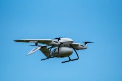
Skyports joins Thales in COVID-19 drone-delivery trial
June 4, 2020
Skyports and Thales are partnering to conduct a drone delivery trial for the National Health Service (NHS) to […]
Read More

Skyports and Thales are partnering to conduct a drone delivery trial for the National Health Service (NHS) to […]

Research contract to protect satellite signals from interference Cobham Aerospace Connectivity will research advanced GNSS anti-jam techniques for […]

The UK’s emergency service responders and other critical services could be set for more resilient time systems through […]
Highly accurate, UK city-wide 3D models are now available to view and download from Bluesky’s online Mapshop. The geographically […]

A new post-Brexit GNSS “must be secured,” according to the UKspace trade association. On Nov. 21, UKspace published […]

With Brexit on the horizon, the U.K. Space Agency is interested in creating its own GNSS. The agency […]

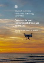
A committee of the U.K.’s House of Commons issued a report calling for greater drone regulations, including registration, […]
Follow Us