Dewberry to update lidar for Puerto Rico and US Virgin Islands after hurricane
June 6, 2018
The U.S. Geological Survey (USGS) has selected Dewberry, a privately held professional services firm, to collect and process […]
Read More
The U.S. Geological Survey (USGS) has selected Dewberry, a privately held professional services firm, to collect and process […]

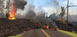
GPS measurements are playing a key role in monitoring the erupting Kilauea volcano in Hawaii. The floor of […]

While not as glamorous as mild-mannered Clark Kent holding down a day job while Superman comes to the […]
New U.S. Geological Survey (USGS) maps show areas that could be affected by Mauna Loa lava flows — […]

New U.S. Geological Survey (USGS) maps show areas that could be affected by Mauna Loa lava flows — […]
Free and rapid imagery was provided through the USGS Hazard Data Distribution System. The calls for assistance started […]

A new tool that gives users a detailed view of the world’s mountains is now available from the U.S. […]

Using live data from USGS and Waze, a new Esri interactive map visualizes active wildfire locations and traffic alerts […]
Follow Us