Korea testing gridded VRS for better GNSS accuracy
October 1, 2025
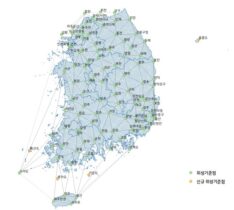
South Korea has launched a test operation of a new GPS-based positioning service, reports the Korea Herald. The […]
Read More
South Korea has launched a test operation of a new GPS-based positioning service, reports the Korea Herald. The […]

As a geodetic surveyor, I served in the U.S Army for 10 years. During that time, my team and I developed a nationwide GPS infrastructure system called the Iraqi Geospatial Reference System (IGRS). We installed Continuously Operating Reference Stations (CORS) and High Accuracy Reference Network Stations (HARNS), the first Iraqi owned and maintained system of its type.


Follow Us