GIS technology plays crucial role in wildfire management and response
February 7, 2025
During times of emergency, geographic information systems (GIS) specialists come together to create real-time mapping tools.
Read More
During times of emergency, geographic information systems (GIS) specialists come together to create real-time mapping tools.
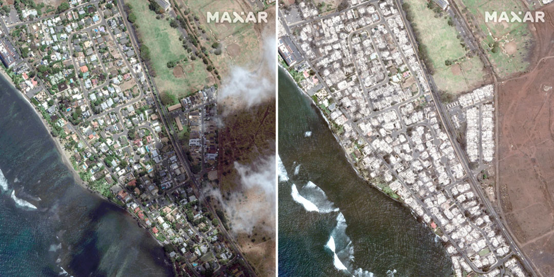
The number of wildfires this year only increases as the island of Maui, Hawaii has been struck by several wind-whipped wildfires fueled by Hurricane Dora.
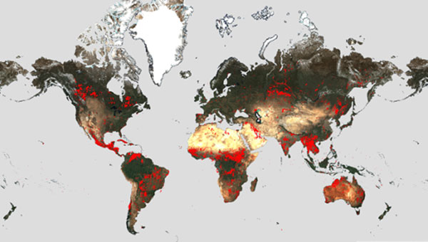
Wildfires have recently spread across Greece, Italy, Spain, Portugal, Algeria, Tunisia and Canada, causing mass environmental and economic […]
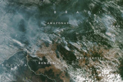
Wildfires in the Amazon rainforest in Brazil have hit record numbers, and satellites have been able to capture […]

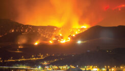
Two fires erupted Monday in Southern California, fueled by strong Santa Ana winds. The Thomas fire in Ventura […]
Following successful test flights, Insitu’s ScanEagle helps combat Oregon wildfire. UAV company Insitu and Esri have successfully completed test flights on a […]
On May 1, a wildfire ignited southwest of Fort McMurray, Alberta, Canada. At first, wildfire MWF-009 seemed like others residents had experienced — smoke and haze, but no real danger. Two days later, the winds shifted.
On May 1, a wildfire ignited southwest of Fort McMurray, Alberta, Canada. At first, wildfire MWF-009 seemed like others residents had experienced — smoke and haze, but no real danger. Two days later, the winds shifted.


Follow Us