No audio available for this content.
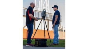
Topcon Positioning Systems and Amberg Technologies are entering into a collaboration agreement and launching fully integrated solutions for rail and tunnel applications. The interoperability of hardware and software platforms is designed to allow professionals to seamlessly combine technologies from both companies to enhance workflow efficiency and accuracy.
The announcement was made at Intergeo 2025, held Oct. 7-9, in Frankfurt, Germany.
At the show, Topcon also announced an expansion of its geomatics portfolio, featuring advancements in mass data software solutions central to a connected workflow ecosystem. The producs follow
the announcement of the dedicated business structure focused on delivering high-precision technology, software, and services for geomatics.
The agreement with Amberg Technologies comes at a time when increased urbanization is driving demand for new underground infrastructure and placing demands on aging and existing infrastructure. Digitalization and automation can help contractors and civil engineering firms address these critical industry challenges, as well as labor shortages, tight project schedules, and increasingly complex design requirements.
Key capabilities resulting from this collaboration include the ability to utilize Topcon’s advanced positioning technology directly with Amberg’s rail and tunnel hardware and software platforms. This integration streamlines tasks such as track alignment, tunnel profiling, and volumetric analysis. The integrations address the need for technology systems that reduce data translation gaps between different hardware and software platforms, eliminating potential errors that can occur when transferring data between systems.
Geomatics products and services
Foundational tools for Topcon’s connected workflow are Collage and ClearEdge software, which allow for data, feature extraction, and the seamless delivery of results into GIS, BIM or CAD environments. Topcon Collage, available in Site, Office and Web versions, serves as a central data hub, enhancing data sharing among all project stakeholders in both the field and office. Topcon is also introducing the Collage Cloud Connector for improved connectivity with Autodesk platforms and ClearEdge solutions such as EdgeWise or Verity.
Featured hardware and software include:
- CR-H1 handheld scanner: The CR-H1 handheld mapping solution utilizes iPhone Pro devices with integrated LiDAR that collects georeferenced images and employs photogrammetry to create detailed, full-color 3D point clouds. The iPhone connects to the Topcon HiPer CR receiver, enabling centimeter accuracy with RTK corrections from the Topnet Live GNSS corrections service. The receiver and iPhone are both mounted on a specialized handle, so users can easily capture point clouds while walking throughout the job site. The devices needed can quite simply be held in one hand for maximum mobility in the field.
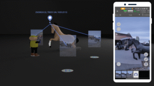
- CR-M1 scanner and new Onami software: The CR-M1 is an indoor/outdoor mapping system that can be utilized on a backpack or on a survey pole. The CR-M1 is ideal for urban and construction mapping, multi-floor buildings, real estate, underground mapping, mines and tunnels, stockpiles, and forestry environments. Publishing and sharing the CR-M1 data with Collage Web allows the user fast, web‑based visualization and manipulation of their 3D point clouds and meshes.
- CR-P1 multi-functional 3D terrestrial laser scanner: The CR-P1 provides real-time, georeferenced point cloud generation on-site, equipping the user with actionable data that can be used for various applications. Enhancements to the Topcon Collage Site software solution provide new mass data workflow capabilities designed to allow for the real-time acquisition and processing of data more accurately, efficiently, and quickly to provide the user with greater productivity.
- CR-S2 handheld scanner with Magnet Flow and Bridge software: The CR-S2 is a handheld scanning system that uses multiple localization fusion-SLAM to perform mapping projects in challenging environments. It is designed to work in construction and infrastructure applications as well as open, featureless environments such as beaches, coastlines, farmland, and airports. In open environments, the RTK connection to the Topnet Live network ensures position quality. Publishing and sharing the CR-S2 data into Collage Web allows the user fast, web-based 3D point cloud and mesh visualization with easy-to-use measurement and annotation tools.
- LN-1000i Layout Navigator withTopcon Digital Layout software: The LN-1000i is an addition to the Layout Navigator series that includes new features, including reflectorless measurement capabilities, green laser beam pointer and an integrated camera for live view, camera control and enhanced prism lock. When combined with the new Topcon Digital Layout 2.0 software, this instrument is designed to set new standards in building construction.
- Expanded Hybrid Positioning capabilities with Topcon software updates for Field – Office – Tools – Enterprise: Allows for better cooperation switching between GT robotic total stations and the HiPer XR GNSS receiver as an optical and GNSS hybrid solution. The new version 10 Topcon Field software enables the user to use the tilt of the IMU when measuring to the prism in Hybrid Positioning mode.
- Collage Cloud Connector: New Windows app designed to simplify and automate the process of downloading and synchronizing project data from Collage Web to a local machine for use with Autodesk, ClearEdge3D software, or Collage Office.

