No audio available for this content.
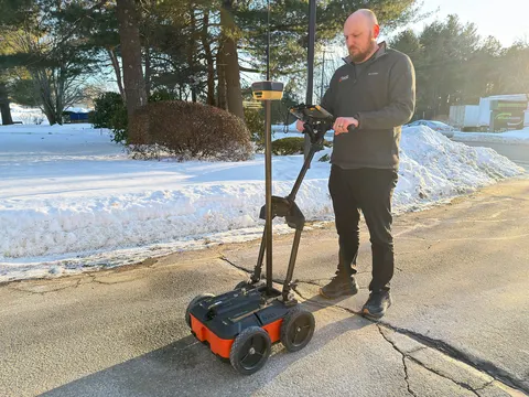
Topcon Positioning Systems and Geophysical Survey Systems, Inc. (GSSI) are collaborating to pair GSSI’s advanced ground penetrating radar systems with Topcon’s GNSS solutions and mass data workflow software. The new integrated solution will support applications across infrastructure and construction projects.
“GSSI is a long-standing industry leader in ground penetrating radar (GPR) systems, and we are excited to work with them on providing industry professionals with an advanced, integrated solution,” said Ron Oberlander, head of the Topcon Geomatics Platform. “By combining GSSI’s GPR technology with Topcon’s HiPer XR GNSS receiver, Topnet Live correction services, and Collage Web mass-data workflow software, we are bridging subsurface detection and spatial context from field to analysis.”
“Collaborating with Topcon allows us to unify GPR data and GNSS data to deliver visual, decision-ready insights, providing a more complete picture of the world above and below the surface,” said Chris Green, chief executive officer of GSSI. “Together, GSSI and Topcon are helping customers plan smarter, validate faster, and deliver higher quality outcomes with fewer surprises.”
The new solution will be showcased in both the Topcon Positioning Systems booth and the GSSI booth at CONEXPO-CON/AGG, taking place March 3-7 in Las Vegas.