Listen to this content
Norway’s geography presents persistent transportation challenges. The country’s complex network of fjords, islands and mountainous terrain forces travelers to rely heavily on ferry systems and intricate routes that can significantly extend travel times between major population centers.
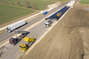
Norway is building an underwater tunnel, one of Europe’s most ambitious engineering projects, which is expected to boost the country’s transport links and infrastructure. Project Rogfast is a 27 km tunnel that will run 392 m below sea level at its deepest point, connecting the cities of Stavanger, Haugesund and Bergen. Upon completion, it will be both the world’s longest and deepest road tunnel. The project is expected to reduce travel times between these major cities by approximately 50%, while eliminating dependence on weather-sensitive ferry connections.
“Traveling in Norway takes time. Efficient roads like Rogfast are crucial for progress,” said Trond Valeur, vice president of Skanska Norway.
Skanska serves as the primary contractor and is executing the project’s construction using a dual-approach method. Two separate teams are drilling and blasting from opposite ends of the tunnel route, with the objective of meeting in the center with a tolerance of 5 cm or less.
When describing the challenge, Rolf Christian Kværnæs, head of Geomatics at Skanska Norway, said, “It’s like two people sitting across from each other, blindfolded, trying to touch fingers.”
Why Precision Matters
The financial and environmental costs of measurement errors in tunnel construction are substantial. According to project data, a deviation of just 10 cm in drilling and blasting operations results in one to two additional truckloads of material removal per session.
“If we are 10 cm out of a lane, it will build up all the way down. It’s not sustainable or economical to do it twice,” said Anne Brit Moen, project manager at Skanska Norway.
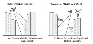
This precision requirement has prompted the use of continuous monitoring systems that track, verify and record each construction phase to reduce rework. The strict accuracy standards for this type of construction pose considerable technical difficulties. Because underground environments block GPS signals, alternative measurement methods are necessary to ensure precision over the extensive length of tunnels.
Technology Integration in Extreme Environments
The surveying team at Skanska depends on Hexagon’s technology daily to ensure precision is up to 5 cm and minimize errors. Hexagon acts as Skanska’s “eyes” underground, without which projects like Rogfast would be impossible.
“Hexagon’s technology scans, checks and documents everything for us, so we know we don’t have to go back,” Valer said.
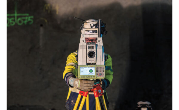
The surveying teams conduct 12 to 18 measurement scans daily using total stations and laser scanners provided by Hexagon. These instruments continuously monitor the tunnel’s alignment and document progress to ensure adherence to design specifications.
The Skanska team is using several Leica Geosystems surveying instruments, including the Leica TS60 and Leica MS60 MultiStation. The Leica TS60 serves as an accurate total station, specifically designed for demanding precision applications such as underground construction.
The Leica Nova MS60 MultiStation is a robotic total station that can measure points with an accuracy of 1 mm to 2 mm and capture 3D scans. This dual functionality combines traditional total station capabilities with integrated laser scanning, allowing the same instrument to perform both precise point measurements and comprehensive area documentation.
In the Rogfast project, these total stations serve as the primary positioning reference system. They establish control networks throughout the tunnel construction, providing fixed reference points from which all other measurements are taken. The robotic capabilities enable automated target tracking and measurement, reducing human error and increasing efficiency in the confined underground environment.
The hardware components work in conjunction with Hexagon’s data processing software, which manages the massive datasets generated by continuous scanning operations. Hexagon’s Geosystems division provides digital solutions that capture, measure and visualize the physical world, enabling data-driven transformation.
The software processes raw measurement data into actionable information, comparing actual construction progress against design models and generating reports that identify areas requiring correction. This integration allows project managers to make real-time decisions based on accurate spatial data.
Project Timeline and Scope
Project Rogfast represents one of several major infrastructure initiatives designed to improve transportation efficiency across Norway’s challenging terrain. The tunnel’s completion, set for 2033, seeks to establish new technical benchmarks for subsea construction while addressing long-standing regional transportation limitations in Norway.