Defense Autonomous Uncategorized SATNUS completes NGWS flight demonstration, validating combat air system development Published May 7, 2026 By Jesse Khalil Join the Discussion The UAV Navigation–Grupo Oesía flight control system, as a subcontractor to SATNUS, proved key to the success of the demonstration. Read more » UAV Navigation-Grupo Oesia
Autonomous Transportation AirData UAV joins the Commercial Drone Alliance ahead of Part 108 adoption Published May 6, 2026 By Tracy Cozzens Join the Discussion The U.S. commercial drone industry is at an inflection point. After years of incremental progress, the FAA’s landmark Part 108 Beyond Visual Line of Sight (BVLOS) rule is expected to take effect later this year, unlocking a new era of scaled commercial drone operations across delivery, infrastructure inspection, public safety, perimeter protection and beyond. It’s […] Read more » beyond visual line of sight BVLOS drone FAA Part 108 UAV
Autonomous Defense Transportation New rule aims to protect critical infrastructure from drone threats Published May 6, 2026 By Tracy Cozzens Join the Discussion The U.S. Federal Aviation Administration (FAA) has issued a proposed rule that would allow specific categories of critical infrastructure sites to apply for restrictions on drone operations around their facilities. The restrictions would be submitted and approved via a new FAA web portal. Approval will be based on safety or security criteria. Sixteen sectors would be eligible […] Read more » B4UFLY critical infrastructure FAA remote ID UAVs
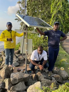
Mapping Research & Development Survey GNSS-IR aids in water-level research Published May 5, 2026 By Tracy Cozzens Join the Discussion Cost-effective sensors from the University of Bonn are measuring water levels along rivers and coastlines in Africa and the Pacific region. Using a low-cost sensor and GNSS Interferometric Reflectometry (GNSS-IR), river water levels can be monitored around the clock. The water-level data are automatically transmitted via cellular networks to an analysis center. Researchers at the […] Read more » Africa Australia ESA Europe GNSS Interferometric Reflectometry GNSS-IR Raspberry Pi Reflector University of Bonn water level
Uncategorized Complementary PNT Team Elaris wins £6M eLoran contract Published May 5, 2026 By Tracy Cozzens Join the Discussion QinetiQ-led Team Elaris has been awarded a £6 million contract with the UK Ministry of Defence (MOD) to develop a deployable solution concept for enhanced long-range navigation (eLoran). Work completed under the two-year Urgent Compass program will be used to inform future demonstration, production and deployment packages of work. The UK and its allies rely […] Read more » eLoran GMV QinetiQ Roke Team Elaris UK Ministry of Defence Urgent Compass UrsaNav
Defense Mobile Transportation Geoforce launches GT1c with AT&T Business for rugged asset tracking Published May 5, 2026 By Tracy Cozzens Join the Discussion Geoforce has launched the GT1c, which enables rugged cellular equipment tracking at scale. According to Geoforce, the GT1c has a more cost-effective, purpose-built design to complement Geoforce’s full range of satellite tracking devices. The GT1c operates on AT&T’s network, built for the next era of IoT connectivity for business. The device’s launch builds on a collaboration with […] Read more » asset tracking AT&T Business Geoforce
Survey Mapping Opinions Update on NC 2022 reference frame working group: Preparing information for NC geospatial providers and users Published May 5, 2026 By David B. Zilkoski Join the Discussion Dave Zilkoski highlights several NC RFWG activities to inform and assist other agencies and working groups. Read more » modernized NSRS NGS NSPS NSRS Survey Scene
Digital Edition Seen & Heard: Arctic Sea ice, Russian jamming and earthquake monitoring Published May 5, 2026 By Tracy Cozzens Join the Discussion New insights into Arctic sea ice Research drawing on data from Spire Global’s GNSS-R constellation has enabled the generation of Arctic-wide sea ice maps, marking a major step forward for GNSS-R. The research, enabled by the European Space Agency — suggests harnessing GNSS-R signals could become an important complement to established ice-monitoring altimetry missions. The […] Read more » 0326 0426 European Space Agency jamming Seen & Heard spoofing TR-TRAK-GNSS Türkiye
Defense GPS USSF terminates GPS OCX program Published May 4, 2026 By Tracy Cozzens 1 Comment on USSF terminates GPS OCX program The GPS Next Generation Operational Control System program of the U.S. Space Force has been cancelled by the Defense Acquisition Executive, based upon the recommendation of the acting service acquisition executive. OCX was intended to update command and control of the GPS satellite constellation, replacing the current system, known as the Architecture Evolution Plan (AEP), […] Read more » GPS Architecture Evolution Plan GPS OCX OCX Raytheon Coyote UAV RTX USSF
Defense Autonomous Elistair’s Khronos Tethered DroneBox takes part in France’s largest joint military exercise Published May 4, 2026 By Tracy Cozzens Join the Discussion Elistair, manufacturer of tethered drones for security applications, participated in Orion 2026, France’s most ambitious joint military exercise in decades. In the exercise, Elistair contributed its Khronos automated tethered DroneBox, used for ISR and tactical communications missions. Running from February to April, ORION 2026 mobilized up to 12,500 military personnel across the country in a high-intensity, […] Read more » dtone Elistair France GNSS-denied Khronos Tethered DroneBox military exercise Orion 2026 tethered drone